


WESLEYVILLE DIST WEST, Erie County, Pennsylvania
About
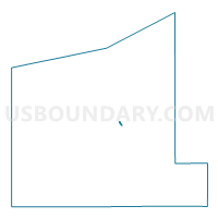
Outline

Summary
| Unique Area Identifier | 659560 |
| Name | WESLEYVILLE DIST WEST |
| County | Erie County |
| State | Pennsylvania |
| Area (square miles) | 0.22 |
| Land Area (square miles) | 0.22 |
| Water Area (square miles) | 0.00 |
| % of Land Area | 100.00 |
| % of Water Area | 0.00 |
| Latitude of the Internal Point | 42.13635400 |
| Longtitude of the Internal Point | -80.01511340 |
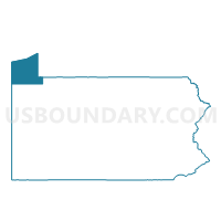
Maps

Graphs
Select a template below for downloading or customizing gragh for WESLEYVILLE DIST WEST, Erie County, Pennsylvania


Neighbors
Neighoring Voting District (by Name) Neighboring Voting District on the Map
- ERIE WD 02 DIST 07, Erie County, PA
- ERIE WD 05 DIST 18, Erie County, PA
- HARBORCREEK TWP DIST 04, Erie County, PA
- LAWRENCE PARK TWP DIST 01, Erie County, PA
- WESLEYVILLE DIST EAST, Erie County, PA
Top 10 Neighboring County Subdivision (by Population) Neighboring County Subdivision on the Map
- Erie city, Erie County, PA (101,786)
- Harborcreek township, Erie County, PA (17,234)
- Lawrence Park township, Erie County, PA (3,982)
- Wesleyville borough, Erie County, PA (3,341)
Top 10 Neighboring Place (by Population) Neighboring Place on the Map
- Erie city, PA (101,786)
- Northwest Harborcreek CDP, PA (8,949)
- Lawrence Park CDP, PA (3,982)
- Wesleyville borough, PA (3,341)
Top 10 Neighboring Unified School District (by Population) Neighboring Unified School District on the Map
- Erie City School District, PA (101,798)
- Harbor Creek School District, PA (17,234)
- Iroquois School District, PA (7,323)
Top 10 Neighboring State Legislative District Lower Chamber (by Population) Neighboring State Legislative District Lower Chamber on the Map
Top 10 Neighboring State Legislative District Upper Chamber (by Population) Neighboring State Legislative District Upper Chamber on the Map
Top 10 Neighboring 111th Congressional District (by Population) Neighboring 111th Congressional District on the Map
Top 10 Neighboring Census Tract (by Population) Neighboring Census Tract on the Map
- Census Tract 123, Erie County, PA (7,783)
- Census Tract 16, Erie County, PA (4,158)
- Census Tract 114, Erie County, PA (3,982)
- Census Tract 113, Erie County, PA (3,341)
- Census Tract 15, Erie County, PA (2,679)